Big Bend National Park
Big Bend is far. It takes real effort to get there, and that keeps crowds low even by national park standards. The Chisos Mountains sit in the middle of the Chihuahuan Desert, and the elevation difference between the basin floor and the South Rim is enough to make them feel like a different environment entirely.
The South Rim in January had overnight temperatures around 25°F. The desert floor visible from the rim was visibly warmer — you can watch dust storms move across the flats from above.
The park borders Mexico along the Rio Grande. Some sections of the river corridor are accessible by day hike. The isolation here is more complete than most parks — no services, limited ranger presence, and a long drive to anything.
Film
Route
Day by Day
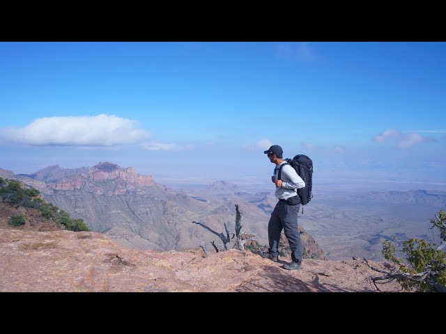
Climbed out of the Chisos Basin via Laguna Meadow Trail. The ascent is gradual through open grassland before reaching the South Rim, which drops off nearly 2,000 feet to the desert below. Camped at one of the South Rim sites.
Followed the South Rim west before turning north into Boot Canyon. The canyon is named for a distinctive hoodoo that looks like an upside-down boot. The Colima warbler — found in the U.S. only in Big Bend — is common in Boot Canyon in winter.
Descended back to the Chisos Basin via the Pinnacles Trail. The basin sits in a ring of mountains that blocks wind and creates a noticeably warmer microclimate than the exposed rim. Long drive out of the park afterward.
Photos
Photos coming soon.