Bryce Canyon National Park
Bryce Canyon is usually experienced from the rim — the overlooks are spectacular and extremely accessible. The Under the Rim Trail does the opposite, putting you in the hoodoos instead of above them.
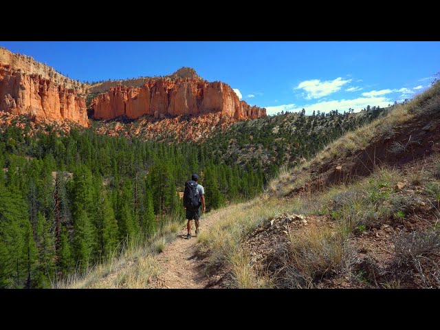
The scale of the formations is hard to appreciate from the top. Walking through them at ground level changes the perspective entirely. Some of the hoodoos are 60 feet tall.
Water is the main logistical concern. There are a handful of springs but some run dry or slow in drought years. Carry more than you think you need.
Film
Route
Day by Day
Started at the Bryce Point overlook and dropped below the rim into the hoodoo formations. The Under the Rim Trail stays below the viewpoints used by day visitors, giving a ground-level view of the same formations. Camped at Yellow Creek.
Continued south along the trail through varied terrain — open meadows alternating with dense ponderosa pine and hoodoo sections. The hoodoos look different from below than from the rim. Camped at Corral Hollow.
Final day climbed back toward the rim, finishing at Rainbow Point, the highest elevation in the park at 9,115 feet. Views extend over 100 miles on clear days.
Photos
Photos coming soon.